Cameroon: Africa in Miniature
Cameroon is a Central African country on the Gulf of Guinea, often called "Africa in miniature" because it combines rainforest, mountains, savanna and Sahel. Its capital is Yaoundé, its largest city and main port is Douala, and it has about 30 million people (2025 UN estimate) in 475,442 km². French and English are both official. Cameroon borders Nigeria, Chad, the Central African Republic, the Republic of the Congo, Gabon and Equatorial Guinea, and became independent from France on 1 January 1960.
Cameroon, officially the Republic of Cameroon, is nicknamed "Africa in Miniature" because its 475,442 square kilometres contain almost every major African landscape: Atlantic beaches and mangroves, equatorial rainforest, volcanic mountains, savanna plateaus and the dry Sahel around Lake Chad. It has about 30 million people from more than 250 ethnic groups, speaking around 250 to 280 languages, and it is one of the few countries where both French and English are official. This page covers Cameroon's position on the map, its geography and climate, its history and its economy.
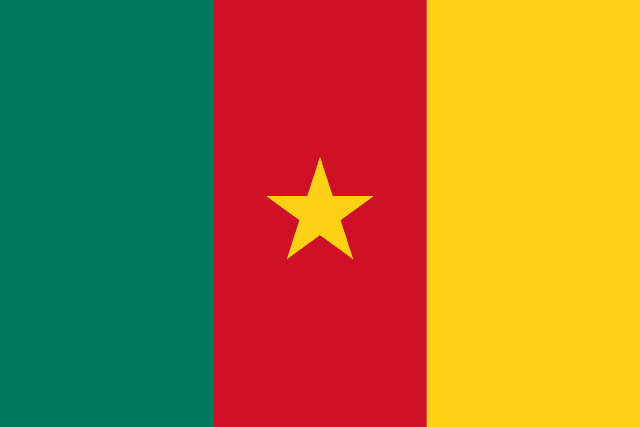
Flag of Cameroon
Cameroon on the Map of Africa
View Cameroon's strategic position bridging West and Central Africa, with coastline on the Atlantic Ocean and borders with six countries:
Map of Cameroon
Explore the detailed map of Cameroon showing its diverse regions, major cities, mountains, and geographical features:

Cameroon Facts at a Glance
| Official name | Republic of Cameroon |
|---|---|
| Capital | Yaoundé |
| Largest city | Douala (Yaoundé is a close second) |
| Region | Central Africa |
| Population | About 30 million (2025 UN estimate) |
| Area | 475,442 km² (183,569 sq mi) – stretching from the Gulf of Guinea to Lake Chad |
| Coastline | Gulf of Guinea coastline of about 400 km |
| Official languages | French and English; around 250 local languages are spoken |
| Currency | Central African CFA franc (XAF) |
| Government | Presidential republic |
| Independence | 1 January 1960, from France (French Cameroun); the British-administered Southern Cameroons joined on 1 October 1961 |
| Neighbouring countries | 6: Nigeria, Chad, Central African Republic, Republic of the Congo, Gabon, Equatorial Guinea |
| Administrative divisions | 10 regions, divided into 58 departments |
| Main cities | Douala, Yaoundé, Garoua, Bamenda, Bafoussam, Maroua, Ngaoundéré |
| Highest point | Mount Cameroon, about 4,040 m (13,250 ft), an active volcano near the coast |
| Rivers and lakes | Sanaga (longest river), Wouri, Nyong, Benue, Logone; Lake Chad in the far north |
| Climate | Equatorial and very wet on the coast and in the south; tropical savanna on the Adamawa Plateau; semi-arid in the far north |
| Economy | Oil, timber, cocoa, coffee, cotton and aluminium; Douala is the main port for Chad and the Central African Republic |
| Time zone | UTC+1 (West Africa Time) |
| Calling code | +237 |
Population figures are rounded 2025 estimates from the UN World Population Prospects 2024 unless stated otherwise. Facts checked September 2026.
See also: Yaoundé city guide, countries of Central Africa, French-speaking countries in Africa, English-speaking countries in Africa, African independence timeline.
Strategic Crossroads of Africa
Cameroon occupies a pivotal position in Africa, straddling the boundary between West and Central Africa while serving as a bridge between the continent's Francophone and Anglophone regions. The country borders six nations: Nigeria to the west, Chad to the northeast, Central African Republic to the east, and Equatorial Guinea, Gabon, and Republic of the Congo to the south. Its 402-kilometer Atlantic coastline provides crucial maritime access, with the port city of Douala serving as a gateway for landlocked Central African countries.
This location has made Cameroon a crossroads for trade, migration and cultural exchange: Bantu-speaking peoples in the forested south, Semi-Bantu (Grassfields) peoples in the western highlands, and Fulani, Kanuri, Shuwa Arab and other groups in the north. Cameroon also hosts large numbers of refugees from the Central African Republic and Nigeria.
Geographical Diversity: The Complete African Experience
Cameroon truly earns its nickname "Africa in Miniature" through an extraordinary range of geographical features that mirror the entire African continent. The country encompasses coastal plains, tropical rainforests, savannas, mountains, plateaus, and even semi-arid regions in the north. This geographical diversity creates distinct ecological zones that support different lifestyles, economic activities, and wildlife populations within a relatively compact territory.
The coastal region features beautiful beaches, mangrove swamps, and the Cameroon estuary where several rivers meet the Atlantic Ocean. Dense tropical rainforests in the south contain some of Africa's most biodiverse ecosystems, home to forest elephants, gorillas, chimpanzees, and thousands of plant species. The central plateau region transitions into guinea savanna with rolling hills and scattered forests, while the northern regions feature sudan savanna and sahel landscapes similar to those found across West Africa's interior.
Mount Cameroon, an active volcano reaching about 4,040 metres, is the highest peak in West and Central Africa and dominates the south-west near the coast; it last erupted in 2012. Known locally as "Mongo ma Ndemi" (Mountain of Greatness), it is one of the wettest places in Africa on its seaward side. It is the most prominent summit of the Cameroon Volcanic Line, a chain of volcanoes that continues inland through the western highlands and offshore to Bioko island. The Adamawa Plateau in central Cameroon forms a watershed between rivers flowing north to Lake Chad and the Benue, and south to the Atlantic.
Climate Zones: From Tropical to Semi-Arid
Cameroon's climate patterns reflect its position spanning from the equatorial region to the edge of the Sahel, creating distinct climate zones that support different agricultural systems and lifestyles. The southern regions experience tropical rainforest climate with high humidity, consistent temperatures around 25°C, and abundant rainfall throughout most of the year. This climate supports dense forests and allows for year-round agriculture of crops like cocoa, coffee, and plantains.
The central plateau region has a tropical savanna climate with distinct wet and dry seasons. Temperatures vary more than on the coast, and rainfall decreases moving northward. This zone supports mixed farming combining crops and livestock, with maize, yams and groundnuts as important food crops. The western highlands around Bamenda, Bafoussam and Dschang are noticeably cooler because of their altitude and are among the most densely farmed parts of the country.
Northern Cameroon experiences increasingly arid conditions, with the far north having a hot semi-arid climate similar to the Sahel region. Rainfall is limited to a brief rainy season, and temperatures can exceed 40°C during the dry season. This climate zone supports pastoralism and drought-resistant crops like millet and sorghum. The dramatic climate variations across Cameroon allow the country to produce an enormous variety of agricultural products while supporting diverse ecosystems and cultures adapted to different environmental conditions.
Cultural Mosaic: Unity in Extraordinary Diversity
Cameroon's cultural landscape represents one of the world's most complex ethnic and linguistic tapestries, with over 250 ethnic groups speaking more than 280 different languages and dialects. This extraordinary diversity stems from the country's position as a meeting point for different migration patterns, trade routes, and cultural influences over thousands of years. Major ethnic groups include the Bamileke, Fulani, Bassa, Duala, and many others, each contributing unique traditions, languages, and perspectives to the national identity.
The colonial legacy added a further division between Francophone and Anglophone regions. After the First World War, German Kamerun was split between France (about four-fifths of the territory) and Britain. The two parts developed different school systems, legal traditions and administrative cultures that persist today: the two English-speaking regions, North-West and South-West, use common law and an English-language school system. French and English are both official, though most Cameroonians also speak local languages, with Fulfulde a lingua franca in the north and Cameroonian Pidgin English widely spoken in the west.
Christianity (Catholic and Protestant) predominates in the south and west, while Islam is prevalent in the north, where it spread through trans-Saharan trade and the 19th-century Fulani jihad that founded emirates such as Adamawa. Traditional beliefs remain influential throughout the country, and religious communities generally coexist peacefully.
Douala: Economic Capital and Gateway to Central Africa
Douala, Cameroon's largest city with several million inhabitants, is the country's economic capital and main port. Located on the Wouri River estuary near the Atlantic, it handles most of Cameroon's international trade and is the main gateway for landlocked Chad and the Central African Republic. A second, deep-water port opened at Kribi in the south in 2018 to take larger ships.
Douala hosts most of Cameroon's manufacturing, including breweries, food processing, cement and consumer goods, as well as the headquarters of major banks and companies. The country's only oil refinery is at Limbe, west of Douala, and its aluminium smelter at Edéa, on the Sanaga River. Rapid population growth strains the city's infrastructure, causing traffic congestion, flooding and housing shortages.
Douala is the centre of Cameroon's popular music scene, the birthplace of makossa, and hosts the annual Ngondo festival of the Duala people. The University of Douala and Douala International Airport, the country's busiest, make it a regional hub.
Yaoundé: Political Capital and Administrative Center
Yaoundé, Cameroon's capital and second-largest city (similar in size to Douala), is the political and administrative centre of the country. Built on a series of hills at about 750 metres in the Centre Region, it has a milder climate than coastal Douala. The city houses the presidency, ministries, parliament, foreign embassies and international organisations.
Major universities including the University of Yaoundé I and University of Yaoundé II establish the city as an important educational center for Cameroon and the broader Central African region. Research institutions, libraries, and academic conferences contribute to intellectual life and policy development. The city's museums, including the National Museum and Blackitude Museum, preserve and showcase Cameroonian cultural heritage for residents and visitors.
Natural Resources and Economic Foundations
Oil from offshore fields near the Nigerian border and in the Rio del Rey basin provides a significant share of government revenue and exports, though reserves are modest and production has declined from its 1980s peak. Natural gas is now also exported as liquefied natural gas from a floating plant off Kribi.
Cameroon is one of the world's larger cocoa producers, grown mainly in the Centre, South and South-West regions, and also exports robusta and arabica coffee, bananas, rubber, palm oil and cotton from the north.
Timber from the southern forests is a major export, though logging raises sustainability concerns. Mineral resources include bauxite, iron ore (a large deposit at Mbalam on the Congo border), gold, cobalt and nickel, but mining remains small relative to its potential. The Edéa smelter processes imported alumina using hydroelectric power from the Sanaga River.
Biodiversity Treasure: Forests and Wildlife
Cameroon's forests contain some of Africa's richest ecosystems, with around 9,000 plant species and more than 900 bird species, including many endemics. The Congo Basin rainforests in the south-east support forest elephants, western lowland gorillas, chimpanzees and hundreds of other mammal species.
Protected areas cover a significant share of the country, from coastal mangroves to montane forest. The Dja Faunal Reserve is a UNESCO World Heritage Site, and Lobéké National Park is part of the Sangha Trinational World Heritage Site shared with the Central African Republic and the Republic of the Congo. Waza National Park in the far north protects savanna wildlife, though insecurity has limited access in recent years.
The Cameroon Highlands, including Mount Cameroon and surrounding areas, harbor extraordinary endemic species adapted to volcanic soils and highland climates. These mountains support unique plant communities found nowhere else, including numerous orchid species, giant lobelias, and other endemic flora. Cross River gorillas, found only in the border region with Nigeria, represent one of the world's most endangered primates with fewer than 300 individuals remaining in fragmented forest patches.
Agricultural Diversity: From Cocoa to Cattle
Agriculture employs a large share of Cameroon's workforce and reflects the country's ecological range. Southern rainforest regions produce cocoa, coffee, oil palm, rubber and food crops such as plantains, cassava and yams.
Central plateau regions with savanna climates support mixed farming systems combining annual crops with livestock. Farmers grow maize, groundnuts, beans, and various vegetables while keeping cattle, goats, and poultry. This diversified approach provides food security and income generation while spreading risks across different production systems. Highland areas around the Adamawa Plateau support temperate crops including potatoes, vegetables, and improved livestock breeds.
Northern regions practise pastoralism and dryland farming. Fulani (Mbororo) herders move cattle seasonally between grazing areas, and farmers grow millet, sorghum and cotton, with irrigated rice along the Logone River. This diversity makes Cameroon an important food supplier to neighbouring Central African countries.
Transportation Networks: Connecting Diverse Regions
Cameroon's transportation infrastructure reflects both the country's geographical challenges and its role as a regional hub connecting landlocked Central African countries to maritime ports. The road network covers most of the country, though quality varies significantly by region and season. Major highways connect Douala and Yaoundé to regional centers and neighboring countries, while rural roads often become impassable during rainy seasons, isolating communities and limiting market access.
The railway, operated by Camrail, links the port of Douala to Yaoundé and continues north-east to Ngaoundéré, carrying freight such as containers, fuel, timber and goods bound for Chad. Proposed extensions to Chad and the Central African Republic would improve regional connections.
Douala International Airport is the country's main air gateway, and Yaoundé-Nsimalen International Airport serves the capital; smaller airports such as Garoua and Maroua serve the north.
Education and Human Development
Cameroon's education system reflects the country's bilingual heritage, with schools operating in French and English depending on regional location and administrative history. Primary education is officially free and compulsory, though access remains limited in rural areas and quality varies significantly between regions. Secondary education includes both general academic programs and technical/vocational training designed to provide practical skills for economic development.
Higher education includes about a dozen state universities spread across the regions, including the Universities of Yaoundé I and II, Douala, Buea (English-speaking) and Dschang, plus many private institutions. Emigration of graduates to Europe and North America is a significant challenge.
Literacy rates vary significantly by region, gender, and language, with urban areas and southern regions generally achieving higher levels than rural and northern areas. Women face particular barriers to education in some regions due to cultural practices and economic constraints. International development programs work to improve educational access and quality, particularly for girls and marginalized communities. Technical and vocational training programs aim to provide skills relevant to economic development needs, though they require expansion and better equipment to meet labor market demands.
Health Care and Social Development
Cameroon's health system faces limited infrastructure, shortages of medical staff and low public funding, and services are much better in cities than in rural areas. Care is provided by public hospitals and clinics, church-run and private facilities, and traditional healers.
Malaria remains the leading cause of illness and death, particularly among children and pregnant women. Government programs and international partnerships provide bed nets, antimalarial drugs, and prevention education to reduce malaria transmission. HIV/AIDS prevalence is moderate compared to southern African countries but requires continued prevention and treatment efforts. Maternal and child health programs work to reduce deaths during childbirth and improve child nutrition and development.
Traditional medicine plays important roles in health care, particularly in rural areas where access to modern medical facilities is limited. Traditional healers treat various conditions using plant medicines and spiritual practices that have been developed over generations. Efforts to integrate traditional and modern medicine aim to improve health outcomes while respecting cultural practices and indigenous knowledge systems.
History: From Kamerun to the Republic of Cameroon
Portuguese navigators reached the Wouri estuary in 1472 and named it Rio dos Camarões ("river of prawns"), the origin of the country's name. Inland, the north was part of the Kanem-Bornu sphere and later the Fulani emirates, while the Bamum kingdom at Foumban developed its own script. Germany made the territory the colony of Kamerun in 1884. After the First World War it was divided between France and Britain as League of Nations mandates, later UN trust territories.
French Cameroun became independent on 1 January 1960. In a UN-supervised plebiscite in 1961, the British Southern Cameroons voted to join it, forming a federal republic on 1 October 1961, while the Northern Cameroons joined Nigeria. The federation was replaced by a unitary state in 1972, and the country took the name Republic of Cameroon in 1984. The Bakassi Peninsula, long disputed with Nigeria, was awarded to Cameroon by the International Court of Justice in 2002 and handed over in 2008.
Political Stability and Governance
Cameroon is a unitary presidential republic in which power is highly centralised. The country has had very long-serving heads of state since independence, and presidential term limits were removed in 2008. Multi-party politics was restored in 1990, but the ruling party has dominated every election since.
Governments try to balance ethnic groups, regions and the two linguistic communities in appointments. Since 2016, however, protests by lawyers and teachers in the English-speaking North-West and South-West regions escalated into an armed conflict between separatist groups and the army (the "Anglophone crisis"), which has displaced hundreds of thousands of people. In the Far North, attacks by Boko Haram and related groups have continued since about 2014.
Regional councils were elected for the first time in 2020 under a decentralisation law, and the two English-speaking regions received a "special status" in 2019. Corruption remains a significant challenge.
Regional Leadership and International Relations
Cameroon is a member of the Economic and Monetary Community of Central Africa (CEMAC), whose central bank issues the CFA franc it uses, of the Economic Community of Central African States (ECCAS) and of the African Union. Reflecting its dual heritage, it belongs to both the Commonwealth (since 1995) and the Organisation internationale de la Francophonie.
France remains a major partner in trade, investment and culture, while China has become an important financer of infrastructure such as the Kribi port, dams and roads.
Regional security cooperation includes the Multinational Joint Task Force against Boko Haram in the Lake Chad Basin and joint efforts against piracy in the Gulf of Guinea.
Tourism Potential: Discovering Africa in Miniature
Cameroon offers visitors rainforest, mountains, savanna and coast in one country. Highlights include climbing Mount Cameroon from Buea, the beaches and Lobé waterfalls at Kribi, the black-sand beaches of Limbe, the royal palace and museums of Foumban, the chiefdoms of the western Grassfields, and the rainforest parks of the south-east. Parts of the North-West, South-West and Far North regions are affected by conflict, so travellers should check current advice.
Cultural highlights include the Ngondo festival of the Duala people, the palaces of Grassfields kingdoms such as Bafut and Bandjoun, Fulani and Islamic traditions in the north, and crafts such as Bamum bronze casting, beadwork and wood carving.
Challenges and Opportunities
Cameroon's development challenges include youth unemployment, high public debt and infrastructure gaps, especially in electricity and roads. Despite large hydropower potential on the Sanaga River, where the Lom Pangar and Nachtigal dams have been built, power cuts remain common.
The conflict in the English-speaking regions and insecurity in the Far North are the main threats to national unity and development. Climate change is shifting rainfall patterns in the north and adding to flooding along the coast, and rapid population growth increases pressure on jobs and services.
Cameroon's strengths are its diversified economy, its role as a transport corridor for Chad and the Central African Republic, its farmland and hydropower potential, and a young, bilingual workforce.
Cameroon at a Glance
On the map, Cameroon forms a hinge between West and Central Africa, stretching from the Gulf of Guinea to Lake Chad. Its capital is Yaoundé, its largest city and port is Douala, and its landscapes range from Mount Cameroon and the rainforests of the south to the savannas and Sahel of the north.
Cameroon: Frequently Asked Questions
What is the capital of Cameroon?
The capital of Cameroon is Yaoundé.
What is the population of Cameroon?
Cameroon has about 30 million people (2025 UN estimate). The largest city is Douala (Yaoundé is a close second).
How big is Cameroon?
Cameroon covers 475,442 km² (183,569 sq mi), stretching from the Gulf of Guinea to Lake Chad.
What language is spoken in Cameroon and what is its currency?
Official languages: French and English; around 250 local languages are spoken. Currency: Central African CFA franc (XAF).
Which countries border Cameroon?
Cameroon borders Nigeria, Chad, Central African Republic, Republic of the Congo, Gabon and Equatorial Guinea.
When did Cameroon become independent?
Cameroon became independent on 1 January 1960 from France (French Cameroun); the British-administered Southern Cameroons joined on 1 October 1961.