Download Africa Maps
Free printable maps of Africa: a labeled political map with all 54 countries and capitals (PDF, JPG, WebP), a blank outline map, satellite and population density maps, regional maps and maps of individual countries. No sign-up is needed – click a button to download. For printing, use the PDF; for slides and documents, use the JPG.
Last updated: September 2026
Maps of Africa
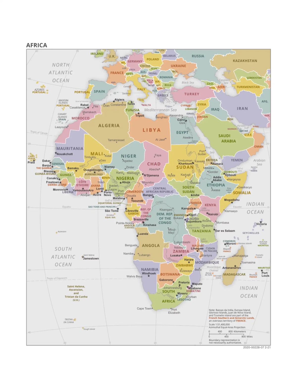
Political Map of Africa (English, labeled)
All 54 countries with names, capitals and major cities, in English. PDF (one page, US Letter), JPG (1200 × 1553 px) or high-resolution WebP (1920 × 2485 px). Based on a 2021 US government map, which still marks Bujumbura as Burundi's capital (now Gitega).


Map of Africa in French (PNG)
Country borders with country names in French (for example “Algérie”, “Afrique du Sud”), without capitals. Useful for French lessons. 1084 × 1024 px.
Download PNG (French)
Satellite Map of Africa
Satellite image of Africa with country borders and names, showing the Sahara, the Sahel and the Congo rainforest.

Population Density Map
Persons per km² across Africa, with cities over 5 million marked. Shows the dense Nile valley, West African coast and Great Lakes region.
Download WebP
Blank Map of Africa
Outline of the continent only (no country borders or labels), for drawing or labeling exercises. 1900 × 1928 px.
Download PNGRegional Maps
North Africa
Political Map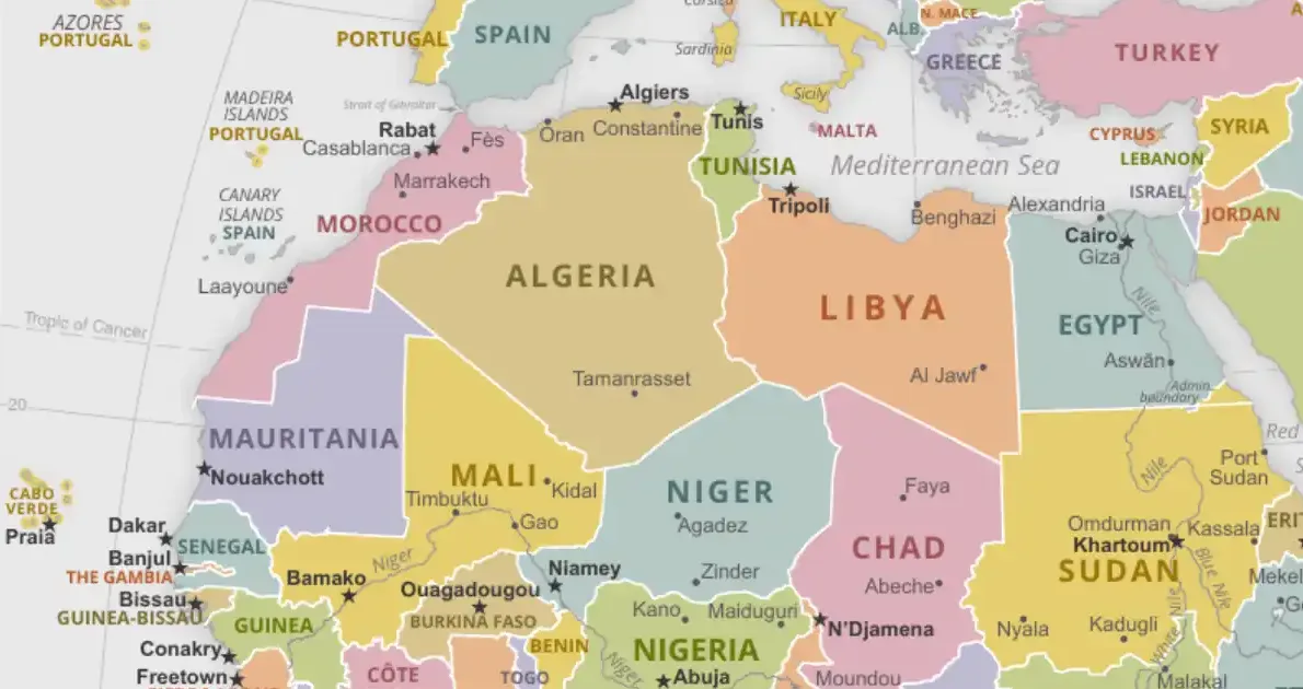
West Africa
Political Map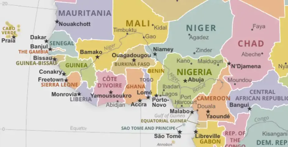
East Africa
Political Map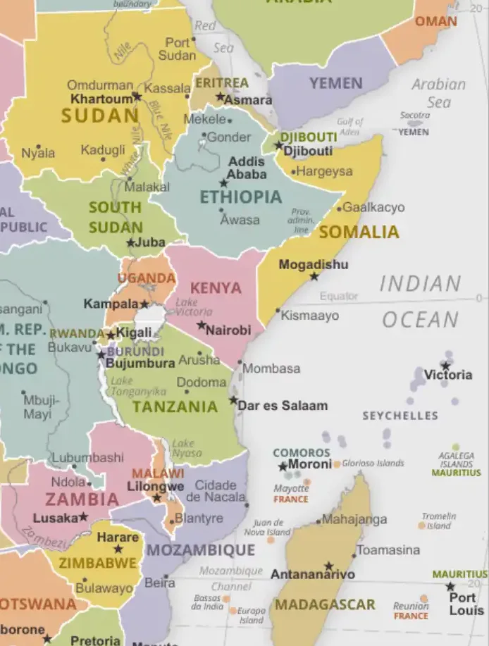
Horn of Africa
Political Map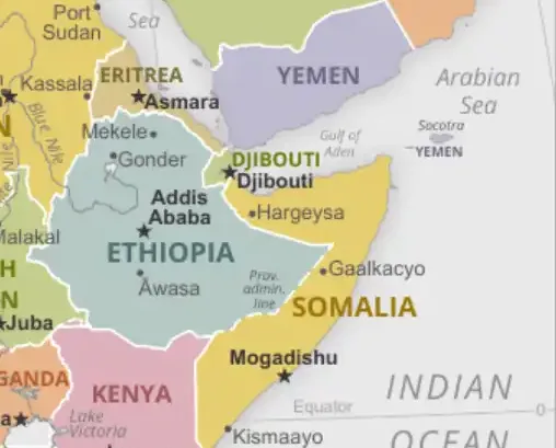
Central Africa
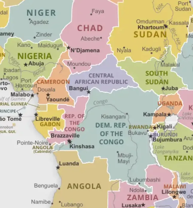

Southern Africa
Political Map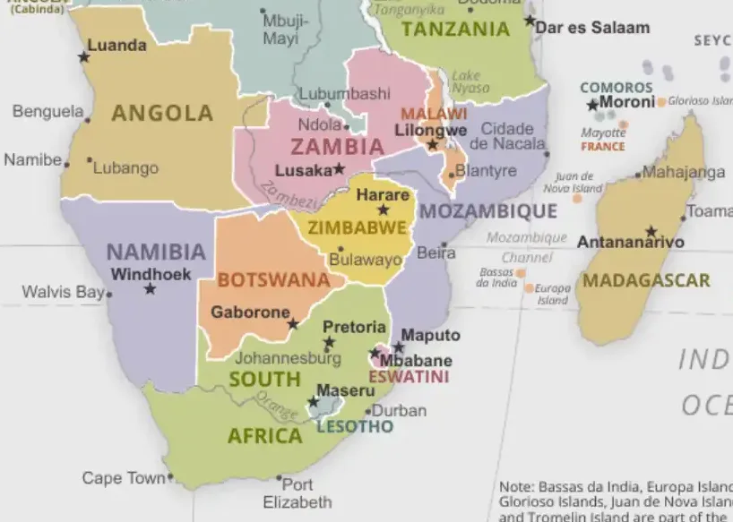
Middle East and North Africa
Political Map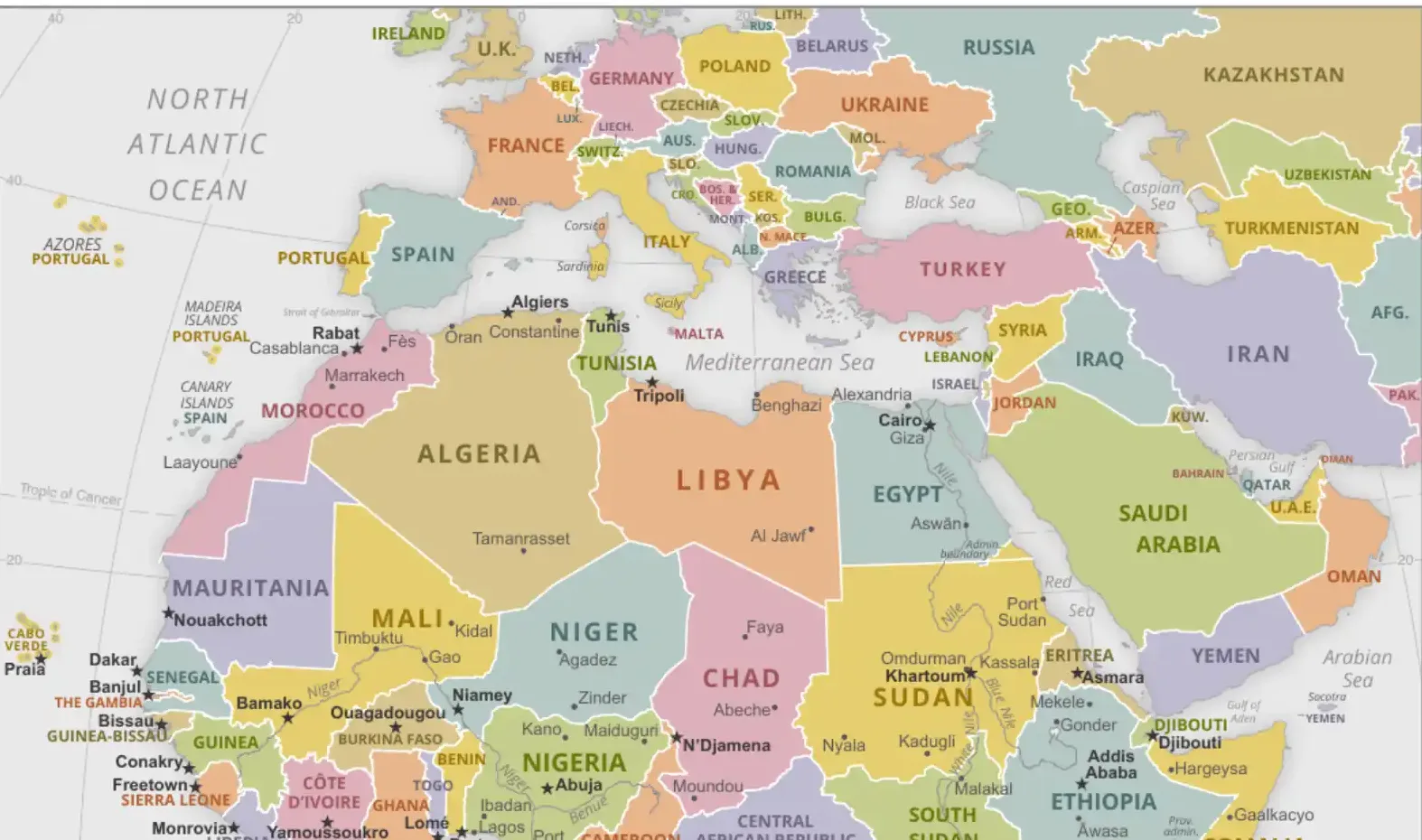
Country Maps - North Africa

Algeria
Political map of Algeria, Africa's largest country by area (about 2.38 million km²).


Egypt
Detailed map of Egypt showing major cities and the Nile River.


Libya
Political and geographical map of Libya.


Morocco
Comprehensive map of Morocco including major cities and regions.


Tunisia
Detailed map of Tunisia showing administrative divisions.


Sudan
Political map of Sudan with states and main cities.

Country Maps - West Africa

Nigeria
Map of Africa's most populous country showing states and major cities.


Ghana
Political map of Ghana with regions and major urban centers.


Senegal
Comprehensive map of Senegal including administrative divisions.


Ivory Coast (Côte d'Ivoire)
Detailed map showing districts and major cities of Ivory Coast.


Mali
Political map of Mali showing regions and the Niger River.


Burkina Faso
Administrative map of Burkina Faso with provinces.

Country Maps - East Africa

Ethiopia
Political map of Ethiopia showing regional states and cities.


Kenya
Detailed map of Kenya showing counties and major landmarks.


Tanzania
Map of Tanzania including Zanzibar and administrative regions.


Uganda
Political map of Uganda showing districts and major cities.


Rwanda
Detailed map of Rwanda showing provinces and districts.


Somalia
Political map of Somalia with regional boundaries.

Country Maps - Southern Africa

South Africa
Comprehensive map showing provinces and major cities of South Africa.


Zimbabwe
Political map of Zimbabwe with provinces and major cities.


Zambia
Detailed map of Zambia showing provinces and districts.


Botswana
Political map of Botswana with districts and major settlements.


Namibia
Map of Namibia showing regions and the Namib Desert.


Mozambique
Political map of Mozambique with provinces and coastal features.

More Country Maps
Browse additional country maps organized alphabetically below.
View All Countries A-Z

Benin


Burundi


Cabo Verde


Cameroon


Central African Republic
Political Map
Chad


Comoros


Congo (DRC)


Congo (Republic)


Djibouti


Equatorial Guinea


Eritrea


Gabon


Gambia


Guinea


Guinea-Bissau


Lesotho


Liberia


Madagascar


Malawi


Mauritania


Niger


Sierra Leone


South Sudan


Togo


Usage and printing
- Free for personal, classroom and other non-commercial use; a link to AfricaMap.net is appreciated. For commercial use, please contact us.
- The labeled political, satellite and population density maps are based on public-domain US government maps. Borders shown are not necessarily authoritative, and Western Sahara is a disputed territory.
- For printing, choose the PDF (fits US Letter; select “fit to page” for A4). JPG and PNG work best in slides and documents; WebP is smallest for websites.
- Need country and capital names in a list? See the map of Africa with all 54 countries and capitals or the list of African capitals.