Algeria: The Largest Country in Africa
Algeria is the largest country in Africa, covering about 2.38 million km² in North Africa between the Mediterranean Sea and the Sahara. Its capital and largest city is Algiers, the population is about 47 million (2025 UN estimate), and the official languages are Arabic and Tamazight (Berber). Algeria borders Tunisia, Libya, Niger, Mali, Mauritania, Western Sahara and Morocco, and gained independence from France on 5 July 1962.
Algeria, officially known as the People's Democratic Republic of Algeria, is the largest country in Africa and the tenth-largest in the world. It covers 2,381,741 square kilometers, stretching from the Mediterranean coast deep into the Sahara Desert. This page covers Algeria's location on the map of Africa, its geography, climate, history, cities and economy.
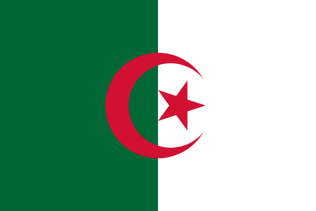
Flag of Algeria
Algeria on the Map of Africa
View Algeria's location on the African continent and explore the detailed map of Algeria below:
Map of Algeria
Explore the detailed map of Algeria showing its diverse geography, from the Mediterranean coast to the Sahara Desert:

Algeria Facts at a Glance
| Official name | People's Democratic Republic of Algeria |
|---|---|
| Capital | Algiers |
| Largest city | Algiers |
| Region | North Africa |
| Population | About 47 million (2025 UN estimate) |
| Area | 2,381,741 km² (919,595 sq mi) – the largest country in Africa and the 10th largest in the world |
| Coastline | Mediterranean coastline of about 1,000 km |
| Official languages | Arabic and Tamazight (Berber); French is widely used in business and education |
| Currency | Algerian dinar (DZD) |
| Government | Presidential republic |
| Independence | 5 July 1962, from France (after the 1954–1962 War of Independence) |
| Neighbouring countries | 7: Tunisia, Libya, Niger, Mali, Mauritania, Western Sahara, Morocco. Algeria's western border includes a short frontier with Western Sahara, a disputed territory. |
| Administrative divisions | Provinces called wilayas (69 since November 2025, when 11 new wilayas were created), divided into districts (daïras) and communes |
| Main cities | Algiers, Oran, Constantine, Annaba, Blida, Batna, Sétif |
| Highest point | Mount Tahat, 2,908 m (9,541 ft), in the Hoggar (Ahaggar) Mountains |
| Rivers and lakes | Chelif (longest river, about 700 km); most other rivers are seasonal wadis |
| Climate | Mediterranean on the coast (mild, wet winters; hot, dry summers); hot desert across the Sahara, which covers more than 80% of the country |
| Economy | Oil and natural gas provide the large majority of export earnings; Algeria is a major gas supplier to Europe by pipeline and LNG |
| Time zone | UTC+1 (Central European Time, no daylight saving) |
| Calling code | +213 |
Population figures are rounded 2025 estimates from the UN World Population Prospects 2024 unless stated otherwise. Facts checked September 2026.
See also: Algiers city guide, countries of North Africa, Arabic-speaking countries in Africa, largest countries in Africa by area, African independence timeline.
Algeria's Strategic Location in Africa
Algeria occupies a prime position in North Africa, serving as a crucial bridge between the Mediterranean world and sub-Saharan Africa. The country is bordered by seven nations: Tunisia and Libya to the east, Niger to the southeast, Mali and Mauritania to the southwest, Western Sahara and Morocco to the west. To the north, Algeria has a coastline of about 1,000 kilometers along the Mediterranean Sea, providing the nation with vital maritime access and beautiful coastal cities.
The country's strategic location has made it a historical crossroads of civilizations. From ancient Berber kingdoms to Roman provinces, from Islamic caliphates to French colonialism, Algeria's position has attracted numerous cultures that have left their indelible mark on the nation's identity. Today, this location continues to play a crucial role in Algeria's economic and political significance within both Africa and the Mediterranean region.
Geographical Features and Natural Wonders
Algeria's vast territory encompasses an extraordinary variety of landscapes that showcase nature's diversity. The northern region, known as the Tell, features fertile coastal plains and the majestic Atlas Mountains. This area enjoys a Mediterranean climate with mild, wet winters and hot, dry summers, making it the country's agricultural heartland where most Algerians reside.
Moving southward, the landscape dramatically transforms into the Saharan Atlas range, a series of mountain chains that serve as a natural barrier between the Mediterranean north and the Saharan south. Algeria's highest point, Mount Tahat (2,908 meters), lies much further south in the Hoggar (Ahaggar) Mountains of the central Sahara.
The southern region is dominated by the Sahara Desert, which covers more than 80% of Algeria's territory. This vast expanse includes some of the world's most spectacular desert landscapes, from the Grand Erg Oriental and Grand Erg Occidental sand seas to the volcanic Hoggar Mountains and the sandstone formations of Tassili n'Ajjer. These UNESCO World Heritage sites feature prehistoric rock art dating back thousands of years, offering glimpses into ancient Saharan civilizations.
Climate Zones and Weather Patterns
Algeria's climate varies significantly from north to south, creating distinct ecological zones. The coastal region enjoys a Mediterranean climate with annual rainfall between 400-700mm, supporting agriculture and dense population centers. Cities like Algiers, Oran, and Constantine experience pleasant temperatures year-round, with summer highs around 30°C and winter lows rarely dropping below 10°C.
The Tell Atlas region experiences a more continental climate with greater temperature variations and rainfall that can exceed 1,000mm annually in some mountainous areas. This region's climate supports diverse forests including cork oak, Aleppo pine, and Atlas cedar, providing important ecological services and economic resources.
The Saharan region experiences an extreme desert climate characterized by minimal rainfall (less than 100mm annually), intense heat during summer (often exceeding 45°C), and surprisingly cold winter nights. Despite these harsh conditions, the Sahara supports adapted flora and fauna, including date palms in oases, drought-resistant acacias, and animals like fennec foxes, addax antelopes, and various reptile species.
Rich Cultural Heritage and Historical Legacy
Algeria's cultural tapestry weaves together Berber (Amazigh), Arab, and Mediterranean influences, creating a unique national identity. The indigenous Berber population, who call themselves Amazigh (free people), have inhabited North Africa for millennia. Their languages, including Kabyle, Shawiya, and Tuareg, remain widely spoken alongside Arabic; Tamazight became a national language in 2002 and an official language in 2016.
The Arab conquest of the 7th century brought Islam and Arabic language, profoundly shaping Algeria's cultural landscape. Today, Islam serves as the state religion, with the majority of Algerians practicing Sunni Islam. The country's Islamic heritage is visible in magnificent mosques, traditional architecture, and social customs that blend seamlessly with local Berber traditions.
French colonization from 1830 to 1962 left another significant cultural layer. The French language remains widely used in education, business, and media, making Algeria one of the world's largest Francophone nations. This colonial period also influenced architecture, urban planning, and administrative systems, creating a unique blend of European and North African elements visible in cities across the country.
Major Cities and Urban Centers
Algiers, the capital and largest city, sprawls along the Mediterranean coast, home to roughly 3 million people in its metropolitan area. Known as "Algiers the White" for its gleaming white buildings cascading down hillsides to the sea, the city combines Ottoman-era Casbah neighborhoods with French colonial boulevards and modern developments. The UNESCO-listed Casbah of Algiers preserves centuries of architectural heritage within its maze-like streets.
Oran, Algeria's second-largest city, serves as a major port and cultural center in the northwest. This cosmopolitan city has long been a melting pot of cultures, reflected in its diverse architecture, vibrant music scene (birthplace of Raï music), and dynamic economy. The city's Spanish and French colonial heritage adds to its unique Mediterranean character.
Constantine, known as the "City of Bridges," dramatically perches atop a rocky plateau split by the Rhumel River gorge. This ancient city, once the capital of Numidia, features spectacular bridges spanning deep ravines, creating one of the world's most dramatic urban landscapes. Its well-preserved Islamic architecture and Roman ruins make it a living museum of North African history.
Other significant urban centers include Annaba, a major industrial port in the northeast; Blida, known for its roses and agricultural products; Sétif, an important commercial hub in the high plateaus; and Batna, gateway to the Aurès Mountains and Berber culture.
Economic Landscape and Natural Resources
Algeria's economy is predominantly based on hydrocarbons, with the country holding some of the largest proven natural gas reserves in Africa and substantial oil reserves. The massive Hassi Messaoud oil field and Hassi R'Mel gas field rank among the world's largest, making Algeria a crucial energy supplier to Europe and beyond. Hydrocarbons account for the large majority of export earnings and a major share of government revenue.
Beyond hydrocarbons, Algeria possesses significant mineral wealth including iron ore, phosphates, uranium, lead, and zinc. The country is also developing its renewable energy sector, particularly solar power, capitalizing on the Sahara's abundant sunshine. The government has set targets to expand solar power substantially, although renewables still supply a small share of electricity.
Agriculture, though limited by arid conditions, remains important for domestic consumption and employment. The northern coastal plains and mountain valleys produce wheat, barley, oats, citrus fruits, grapes, olives, and dates. Algeria is renowned for its high-quality dates, particularly the Deglet Nour variety grown in Saharan oases.
Tourism Attractions and Hidden Gems
Algeria offers extraordinary tourism potential with its diverse attractions spanning from Mediterranean beaches to Saharan adventures. The Tassili n'Ajjer National Park, a UNESCO World Heritage site, showcases one of the world's most important collections of prehistoric rock art, with more than 15,000 drawings and engravings depicting ancient Saharan life when the region was verdant.
The M'zab Valley, another UNESCO site, features five fortified cities built by the Ibadi Berbers in the 10th century. These perfectly preserved medieval towns demonstrate remarkable urban planning adapted to Saharan conditions, with unique architecture that has inspired modern architects worldwide.
Roman ruins dot the Algerian landscape, with Timgad (the "Pompeii of Africa") offering an exceptionally well-preserved Roman colonial town complete with triumphal arch, theater, and grid-pattern streets. Djémila presents another spectacular Roman site, beautifully situated in a mountain setting with forums, temples, basilicas, and houses.
The Saharan region attracts adventure seekers with experiences ranging from camel trekking in the Grand Ergs to rock climbing in the Hoggar Mountains. The ancient trading city of Ghardaïa serves as a gateway to the Sahara, while the oasis towns of Timimoun and Taghit offer authentic desert experiences with traditional architecture and palm groves.
Transportation and Connectivity
Algeria has invested heavily in transportation infrastructure to connect its vast territory. The Trans-Saharan Highway, stretching from Algiers to Lagos, Nigeria, is one of Africa's most ambitious road projects, facilitating trade and travel across the Sahara. The national road network is extensive in the north, though maintaining roads across desert regions remains challenging.
The railway network, operated by SNTF (Société Nationale des Transports Ferroviaires), connects major northern cities and extends into the Saharan region. Expansion projects aim to link all major cities with modern rail services and eventually connect to the broader Maghreb rail network.
Air travel is served by numerous airports, with Houari Boumediene Airport in Algiers serving as the main international gateway. Air Algérie, the national carrier, connects Algeria to destinations across Africa, Europe, and the Middle East, while domestic flights provide vital links to remote Saharan cities.
Education and Human Development
Algeria has made remarkable progress in education since independence, achieving near-universal primary education and significantly improving literacy rates. The education system, free at all levels, includes nine years of compulsory basic education followed by three years of secondary education. The country hosts numerous universities, with the University of Algiers being the oldest and largest.
The government emphasizes scientific and technical education to diversify the economy beyond hydrocarbons. Research institutions focus on renewable energy, water management, agriculture in arid conditions, and petroleum technology. Despite these advances, challenges remain including youth unemployment, brain drain, and the need to modernize curricula to meet contemporary economic needs.
Environmental Challenges and Conservation
Algeria faces significant environmental challenges including desertification, water scarcity, and pollution. The Sahara's northward expansion threatens agricultural lands and communities, prompting the ambitious Green Dam project - a 1,500-kilometer tree belt designed to halt desert encroachment. This massive reforestation effort, begun in the 1970s, has had mixed results but represents one of the world's largest anti-desertification projects.
Water scarcity poses another critical challenge, with Algeria classified as water-poor. The government has invested in desalination plants along the coast and improved irrigation efficiency in agricultural regions. Traditional water management systems, including ancient foggaras (underground channels) in Saharan oases, are being restored and modernized.
Conservation efforts protect Algeria's biodiversity through national parks and reserves. The Tassili n'Ajjer and Ahaggar National Parks preserve unique Saharan ecosystems, while coastal parks protect Mediterranean habitats. Endemic species like the Barbary macaque, Algerian nuthatch, and various desert-adapted plants receive special protection status.
Future Prospects and Development Goals
Algeria stands at a crossroads as it seeks to diversify its economy and address social challenges. Government development plans emphasize economic diversification, renewable energy development, tourism growth, and improved governance. Major infrastructure projects include new cities, industrial zones, and transportation networks designed to spread development beyond coastal regions.
The country's young population (roughly half of Algerians are under 30) represents both a challenge and opportunity. Harnessing this demographic dividend requires job creation, educational reform, and economic modernization. Technology sectors, including IT services and startups, show promising growth, supported by improving internet infrastructure and government initiatives.
Regional integration through the African Union and Arab Maghreb Union offers opportunities for increased trade and cooperation. Algeria's size, resources, and strategic location position it to play a leading role in African development, particularly in energy transition and regional stability.
Algeria on the Map: Summary
On the map of Africa, Algeria sits in the centre of the Maghreb, between Morocco and Tunisia, with the Mediterranean to the north and the Sahara filling most of its territory to the south. It is the continent's largest country, a major gas supplier to Europe, and home to UNESCO sites ranging from the Casbah of Algiers to the rock art of Tassili n'Ajjer.
Algeria: Frequently Asked Questions
What is the capital of Algeria?
The capital of Algeria is Algiers.
What is the population of Algeria?
Algeria has about 47 million people (2025 UN estimate). The largest city is Algiers.
How big is Algeria?
Algeria covers 2,381,741 km² (919,595 sq mi), the largest country in Africa and the 10th largest in the world.
What language is spoken in Algeria and what is its currency?
Official languages: Arabic and Tamazight (Berber); French is widely used in business and education. Currency: Algerian dinar (DZD).
Which countries border Algeria?
Algeria borders Tunisia, Libya, Niger, Mali, Mauritania, Western Sahara and Morocco. Algeria's western border includes a short frontier with Western Sahara, a disputed territory.
When did Algeria become independent?
Algeria became independent on 5 July 1962 from France (after the 1954–1962 War of Independence).